
BioBase™ Sonar Surveys
As a BioBase™ Ambassador, Amaruq Environmental Services is proud to have conducted some of the largest contiguous river surveys in North America if not the world. BioBase is the commercial mapping arm of Lowrance/Navico Group (a Brunswick Division). The BioBase platform automates the processing of sonar files with sophisticated automated algorithms on cloud-based servers.
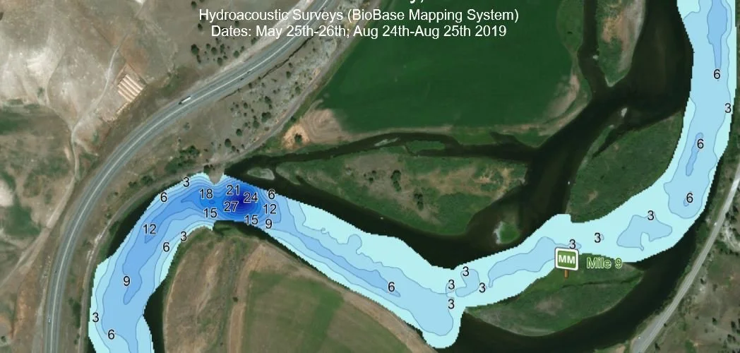
Aquatic Vegetation Density
The typical BioBase survey will capture site bathymetry (depth contours), standing aquatic vegetative mass as percent biovolume (at the time of survey), and relative bottom composition (soft : hard). This data is useful not only for aquatic vegetation mitigation projects, but also can be useful to track changes in channel morphology as a result of high flows or through anthropogenic activities. The technology can even track the movement of soft sediments within dynamic systems such as rivers or in mine waste tailings ponds.
Amaruq Environmental Services utilizes the BioBase Platform for two primary reasons; Firstly, PRE-mitigation project site surveys ensure that our team has a hyper-accurate measurement of site water volumes and are not relying on “as built” specifications which can change over time or relying on less accurate or time-intensive drop-point measurements. Second, a POST-mitigation survey provides the “proof” to our clients that our efforts have worked through measurable reductions in aquatic vegetation density (or elimination as the case warrants).
We’re in the news!

On-site generated SONAR files are processed automatically upon upload, and high-quality maps and spatial datasets are generated and made available in a number of formats (.pdf, .xls, .csv, .kml, & .kmx) for exporting to a third-party GIS or statistical software and for distribution to project partners, stakeholders and/or customers.
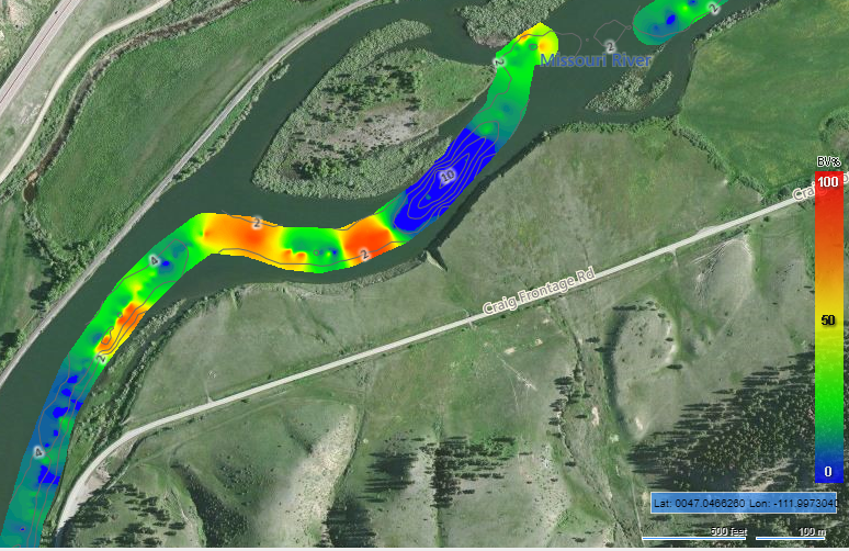
River Channel Bathymetry

Aquatic Vegetation Density
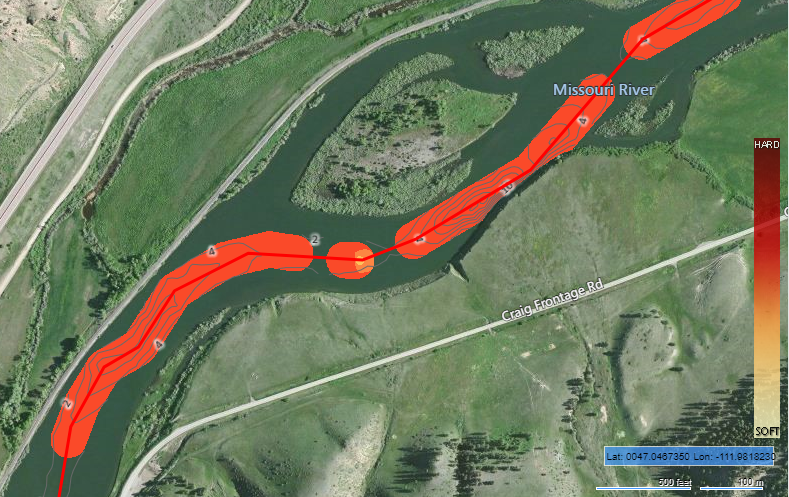
River Channel Sediment Composition